
Coral Springs ZIP Directory Areas
Four residential ZIPs appear in the city's 2025 community survey: 33065, 33067, 33071, and 33076. They divide Coral Springs into useful search zones, but they are delivery areas rather than legal city districts. Two other codes, 33075 and 33077, serve post office boxes rather than residential neighborhoods. Begin with the residential code tied to an address, then check the physical parcel before treating the postal city as the government jurisdiction.
| ZIP | Coral Springs area | Postal facility | Record-search note |
|---|---|---|---|
| 33065 | Central and eastern city, including the Sample Road civic core | Coral Springs Post Office | Largest survey share; Coral Springs mailing city |
| 33071 | South-central and southeastern city, including Ramblewood and University-Sample areas | Atlantic | Perceived neighborhood lines may not match the ZIP edge |
| 33067 | Northeastern city and an adjacent north Broward mailing area | Coral Reef | Verify whether each parcel is inside Coral Springs |
| 33076 | Northern and northwestern newer development toward Parkland | No distinct retail facility confirmed | Shared postal geography needs a city-limit check |
| 33075 | PO boxes, not a residential neighborhood | Coral Springs Post Office | Preferred last line changed in 2011 |
| 33077 | PO boxes, not a residential neighborhood | Atlantic | Do not use as a residential search zone |
The facility addresses also show why one label cannot do every job. The Coral Springs Post Office is at 3255 NW 94th Avenue, Atlantic is at 8801 West Atlantic Boulevard, and Coral Reef is at 6295 West Sample Road. USPS changed the preferred last line for 33075 from Pompano Beach to Coral Springs in 2011. It changed 33065 and 33071 in 2016. Those updates changed postal naming, not the municipal boundary.
Coral Springs ZIP Survey Numbers
The city's survey provides a rare local check on how its residential codes were represented. Among 1,120 respondents, 411 reported 33065, 376 reported 33071, 185 reported 33076, and 148 reported 33067. In percentage terms, the split was 36.7%, 33.6%, 16.5%, and 13.2%, respectively.
These figures make the four-code pattern easy to see, but they are not ZIP-level population totals. The respondents form a survey group, not a census count. Use the numbers as city-produced evidence that all four codes serve Coral Springs residents. Do not turn them into claims about how many people live in each delivery area.
Reading the numbers. Survey shares confirm geographic representation; they do not measure the full population of any Coral Springs ZIP.
Verify a Coral Springs ZIP
USPS is the source for the delivery code assigned to a complete mailing address. Enter the house number, street, city, and state, then preserve the standardized address and ZIP+4 returned. A ZIP+4 narrows delivery to a smaller segment such as a side of a block, an office group, or a box range. It still does not define a parcel or city jurisdiction.
The USPS ZIP Code Lookup shows the official address-to-ZIP entry point.
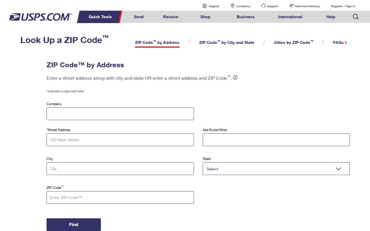
The screen is the right first check when a directory entry, old letter, or online listing has an uncertain postal code. Take the standardized result to the county map rather than assuming the postal last line also proves Coral Springs jurisdiction.
Coral Springs ZIP Search Fields
The Broward County Property Appraiser does not offer a verified one-click export of every resident in a ZIP. Its property search and Web Map instead let a researcher move from an address or folio to a parcel, then view the ZIP and city-limit layers. A folio is Broward's parcel identifier. It is more stable than a mailing label and helps join a property card to maps and recorded land documents.
| Field or tool | Input | What it contributes | Important limit |
|---|---|---|---|
| Address | House and street | Finds the physical, or situs, parcel | Use the normalized street form |
| Property ID / Folio | Exact parcel identifier | Reopens the same tax parcel | Not a resident identifier |
| ZIP Codes layer | Map checkbox | Shows postal geography around the parcel | No verified resident export |
| City Limits layer | Map checkbox | Tests municipal jurisdiction | Separate from the ZIP line |
| Subdivision and legal | Parcel details | Connects the site to plats and deeds | Describes land, not all occupants |
This sequence keeps the Coral Springs ZIP code directory focused on postal geography. When the task shifts to every parcel on a named road, the Coral Springs street directory explains the street-level chain.
Find Coral Springs Residents by ZIP
A ZIP narrows the search, but no official source publishes a complete household directory. The practical method starts with a verified address, uses BCPA to establish the parcel and owner of record, and checks the map layers. Broward Elections handles a public voter-file request separately from its individual verification form. Protected addresses and confidential identifiers stay suppressed.
- Verify the full mailing address and ZIP+4 through USPS. Keep the standardized street spelling.
- Search the address in BCPA. Save the folio, owner name, situs, mailing address, and legal description.
- Open BCPA Web Map and turn on ZIP Codes and City Limits. Check whether both boundaries support the same conclusion.
- If a lawful block or ZIP-level voter record is needed, ask Broward Elections for an existing extract. The office need not create a new analytic directory.
- Cross-check a specific person with the individual voter lookup only when the required first name, last name, birth year, and house number are known.
The Broward Supervisor of Elections site is the official election-record entry point.
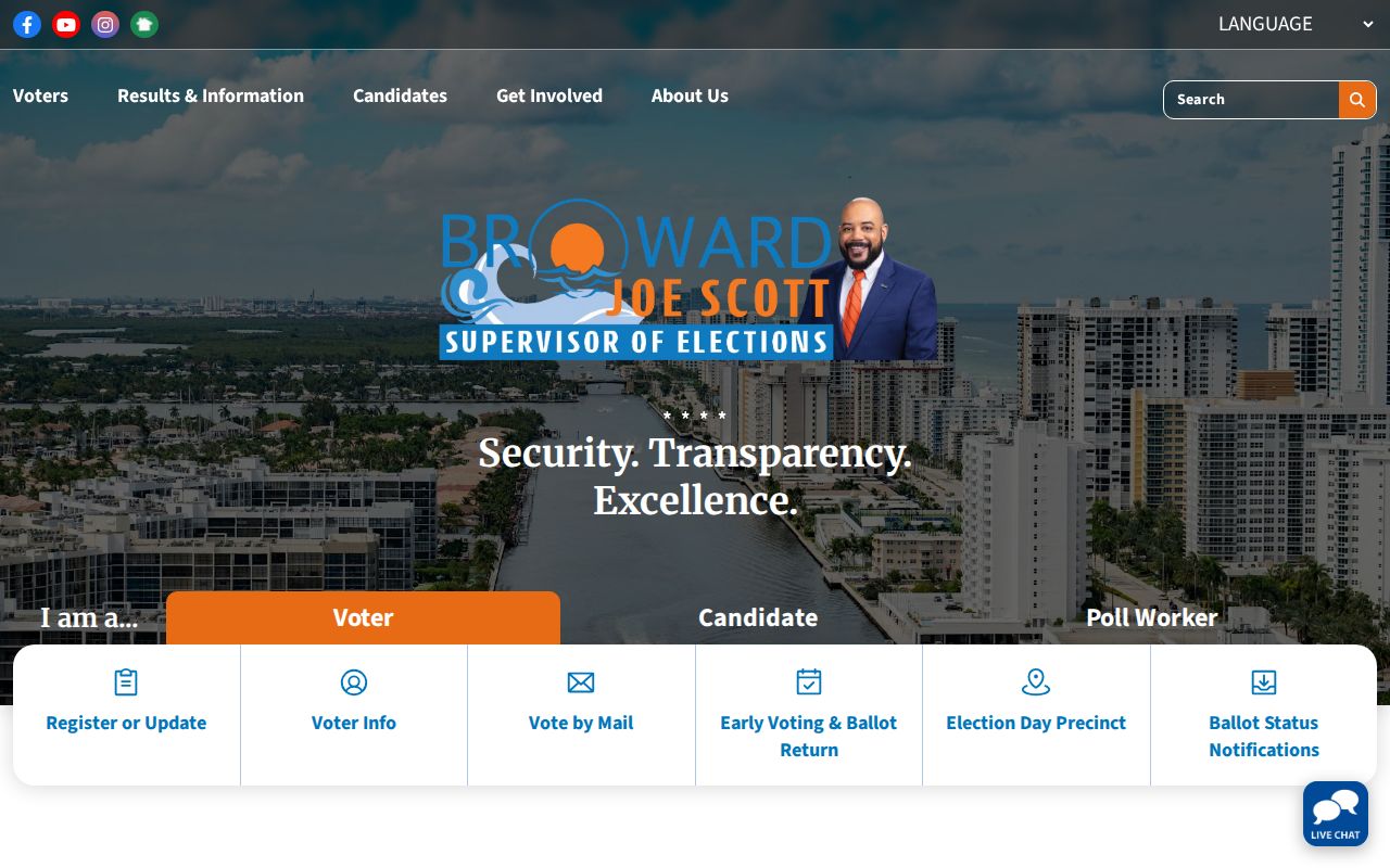
The election portal confirms the proper custodian, while a data request and the four-field self-lookup remain distinct channels. Neither should be described as a public street browser.
Three Coral Springs Address Keys
One property can carry three address concepts. The situs address is where the parcel is physically located. The mailing address is where the owner receives correspondence and may be elsewhere. The legal description identifies the land through subdivision, lot, block, or other recorded terms. Confusing them creates false matches in any ZIP code directory search.
- ZIP code
- A USPS delivery area that can cross municipal boundaries.
- ZIP+4
- A finer delivery segment appended to the five-digit postal code.
- PO-box ZIP
- A code used for boxes at a postal facility, not a residential neighborhood.
- Unique ZIP
- A code assigned to one high-volume organization; none was confirmed for Coral Springs research.
- Carrier route
- A postal delivery path that does not serve as a legal city or parcel boundary.
For land records, the folio and legal description are the durable bridge. For mail, keep the USPS-standard address. For city permits or zoning, confirm the city-limit layer and then use the Coral Springs planning source.
Coral Springs ZIP Community Layer
ZIP geography can point toward a part of town, but neighborhood identity comes from subdivisions and associations. The city's Neighborhood Partnership Program registers neighborhood, civic, and homeowners' associations. It reports more than 130 formal partnerships and over $1 million in improvements. The city does not publish a member or household directory.
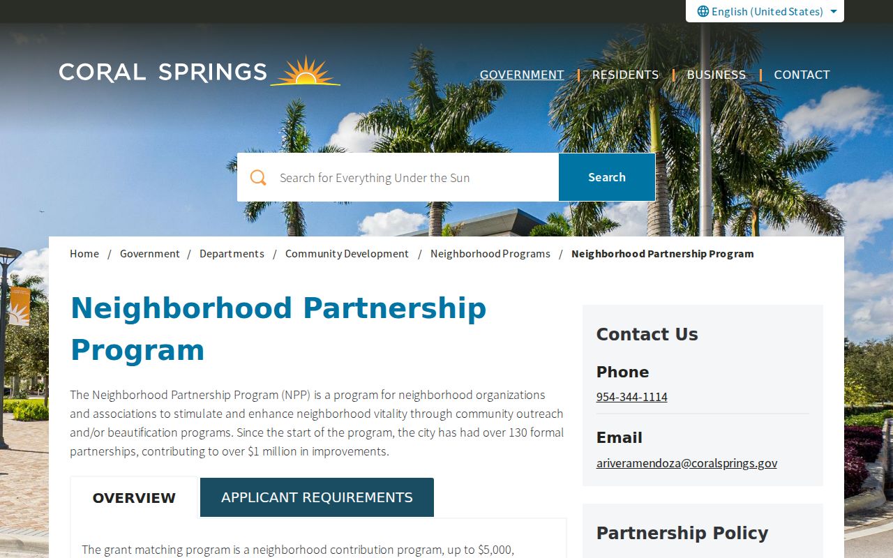
Association names, boundaries, and official contacts can refine a broad ZIP lead. They should not be used to infer who belongs to a group or who lives in each home.
Coral Springs ZIP and City Lines
The mismatch is clearest near Parkland and the north Broward edge. A 33067 or 33076 address may use Coral Springs as its postal city while the parcel lies outside the municipal line. The reverse question also matters: service districts, school zones, and police jurisdiction cannot be derived from a ZIP label. Turn on both ZIP Codes and City Limits in BCPA Web Map, then inspect the parcel's millage, use, and legal fields.
Coral Springs is also served by four water districts. That fact reinforces the point. Even inside one familiar city name, the agency holding a service record can vary by location. Use the city's service-area map for the provider, and do not treat utility customer data as a public resident roll.
Boundary check. A Coral Springs postal last line shows mail routing, not city jurisdiction, school assignment, or the agency holding a local record.
Coral Springs ZIP Affiliation Records
State license and business indexes sometimes accept a city or ZIP and can support an affiliation check. They do not prove that a person lives at the listed office or registered-agent address. Search by the claimed name first, then compare the city, license type, status, and dates to another official source.
The Florida DBPR license portal shows its name, license number, city or county, and license-type routes.
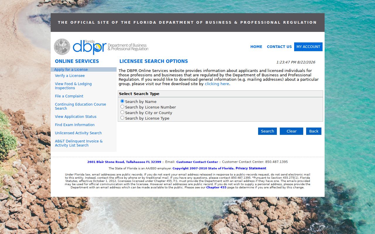
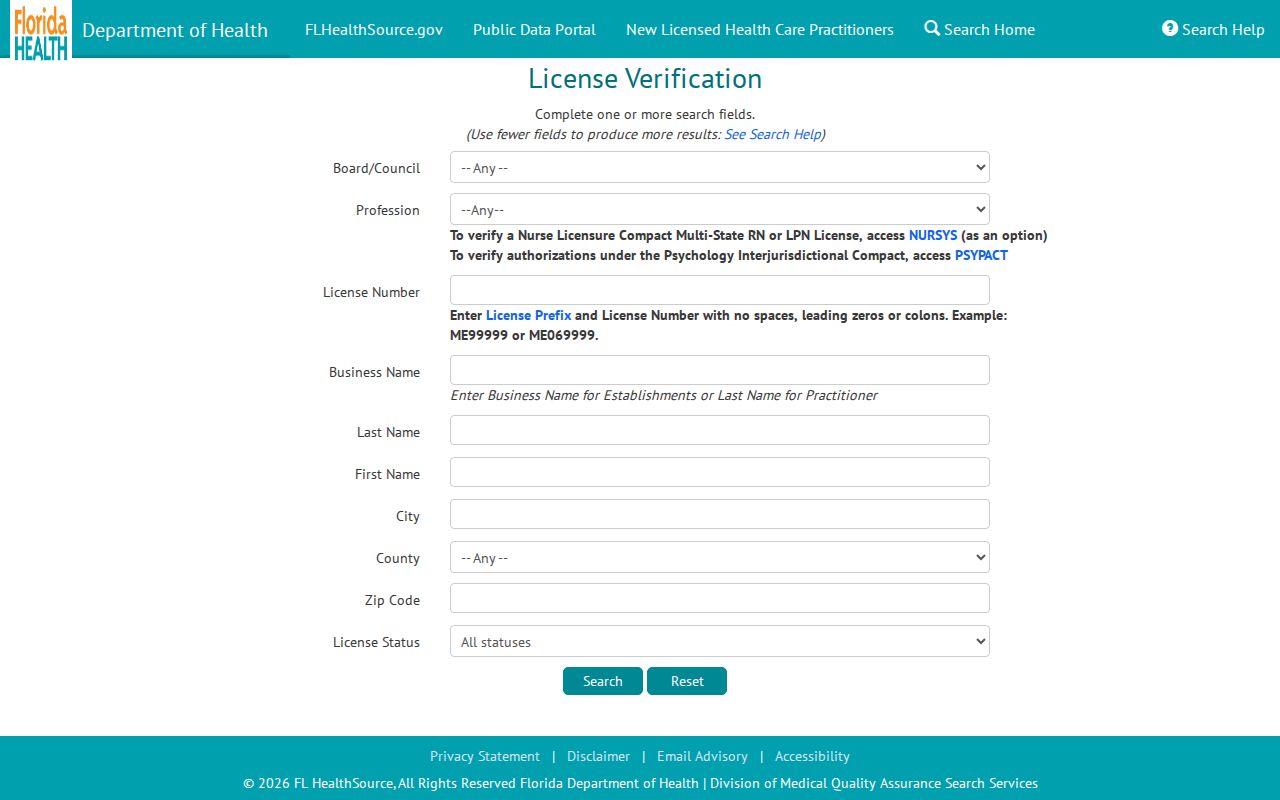
DBPR covers a broad set of regulated fields. Health professions use the separate MQA search, so the type of credential determines the correct portal.
The Florida MQA provider search is the official health-license channel.
These indexes add a current professional or business link to the ZIP search. Treat the address as an affiliation field unless an independent residential record supports more.